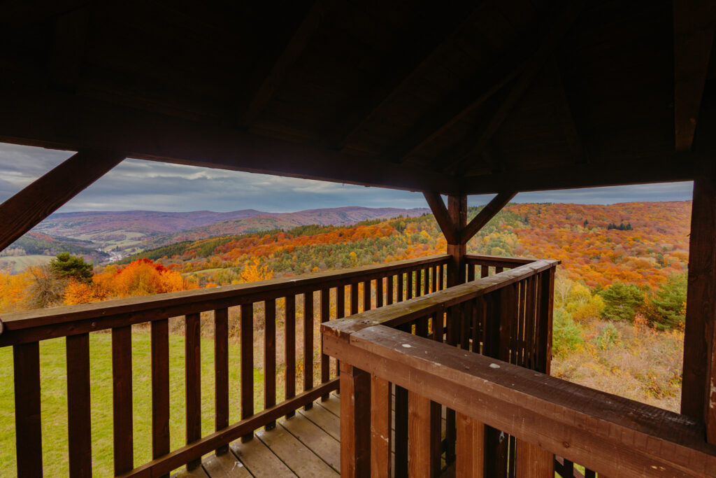
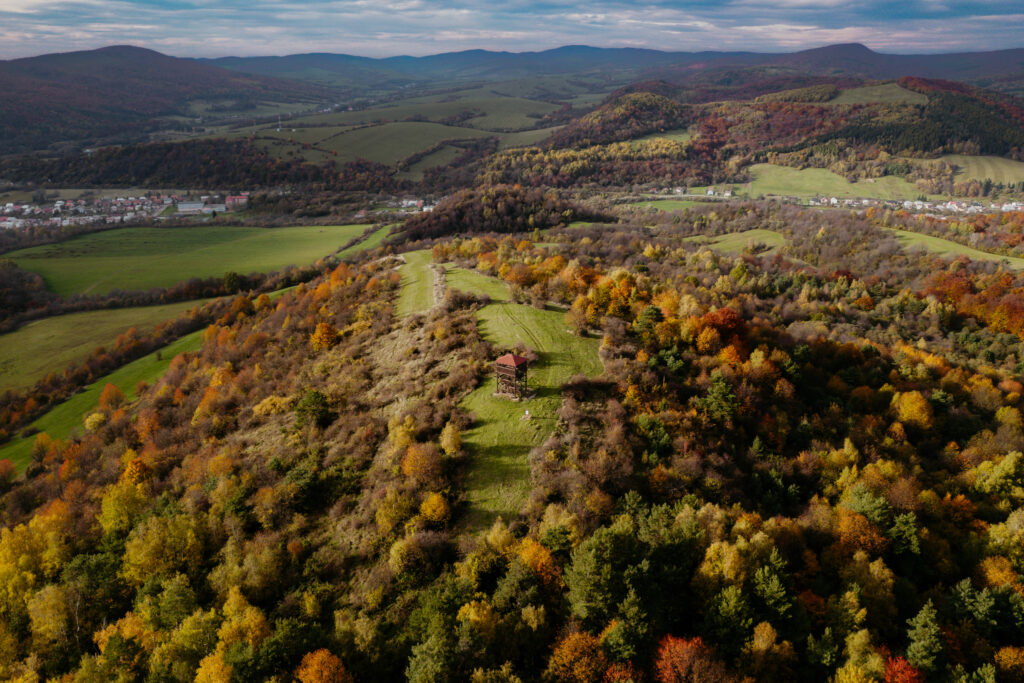
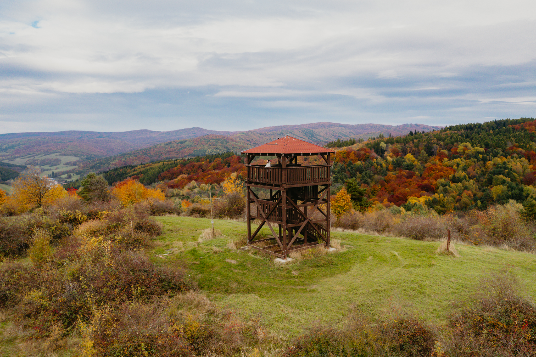
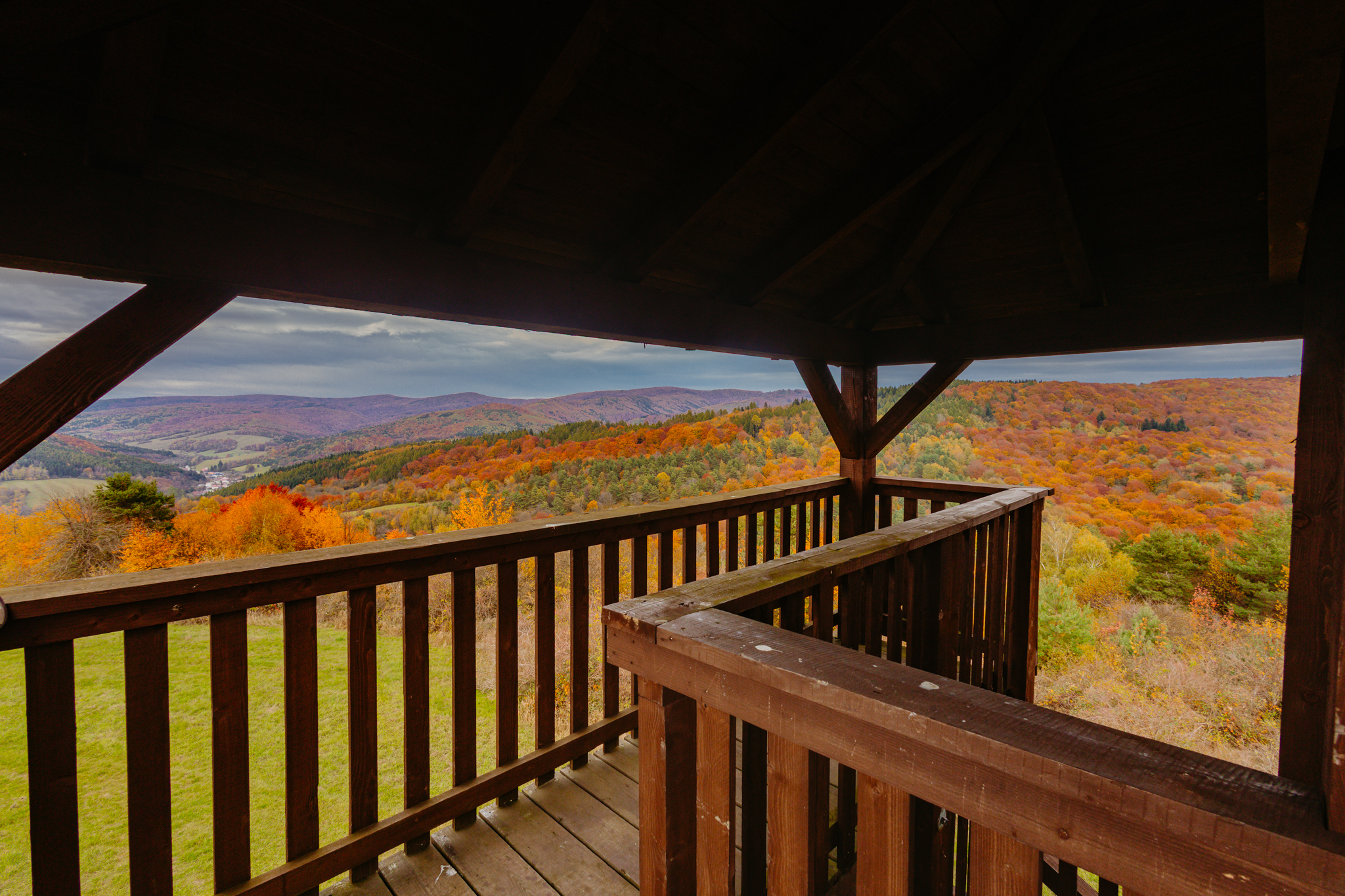
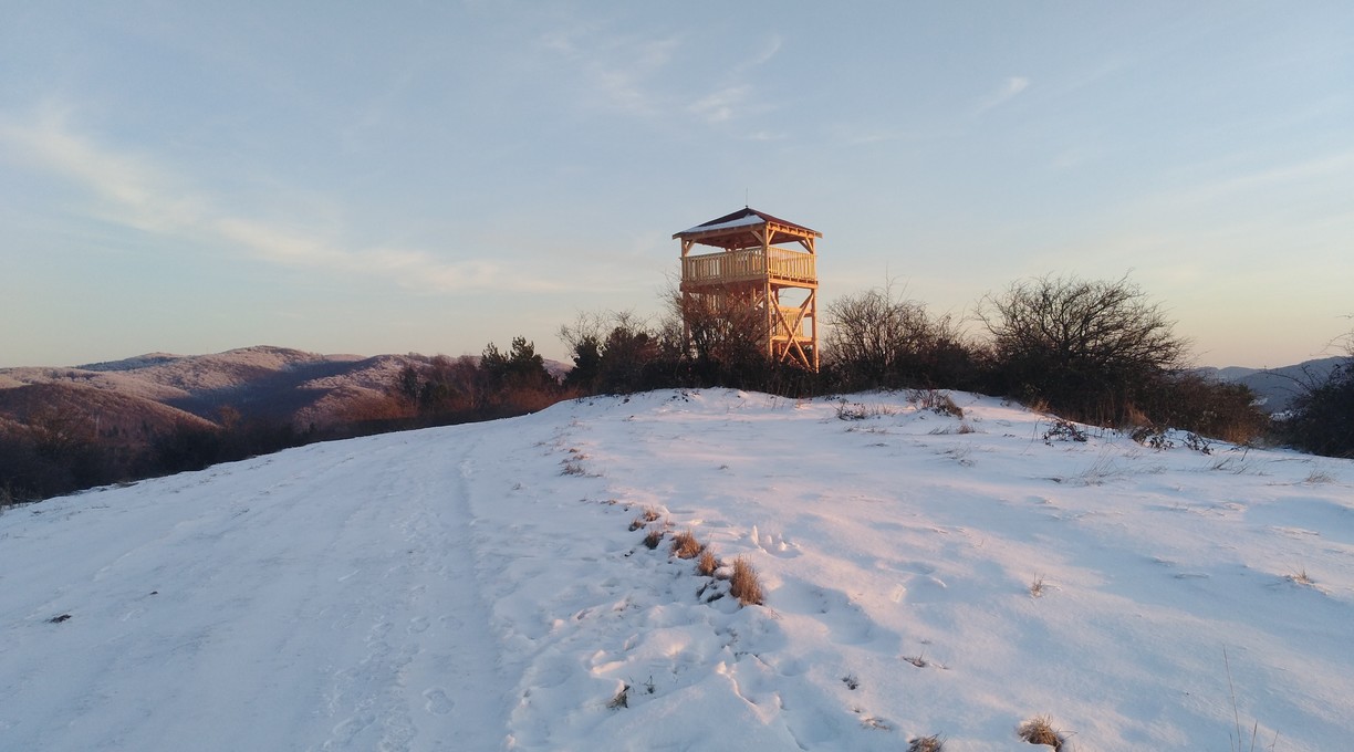
The Kyčera observation tower is a newly built object from which you can observe the wide surroundings of the town of Medzilaborce. It stands on a hill (528 m above sea level), after which it is named. It is almost 10 metres high, has three floors and is made of wood. It can be reached from Medzilaborce, from the streets of Captain Nálepku and Komenského (duration about 1 hour) and from the villages of Vydraň and Ňagov (duration about 1.5 hours).

This is a relatively new attraction in the region, which has been built in 2019. The initiator of the whole construction is the Regional Development Association LABOREC, o.z. Currently, the tower is being completed with resting places and a panoramic map.
The tower is located in the Protected Landscape Area of the Eastern Carpathians. It is therefore important to comply with the rules associated with the Nature and Landscape Conservation Act. For example, it should not be forgotten that driving and standing with a motor vehicle outside the built-up area is prohibited, as well as starting a fire, etc. Every time we go out into nature, we must remember that it will survive without us, but we will not survive without it, and we must therefore treat it with respect.
V okolí rozhľadne sa dodnes ukrývajú zvyšky zákopových línií, ktoré pochádzajú z rokov 1914-1915.
Kyčera patrí do Kraja Rusínov a Andyho Warhola, regiónu, kde sa rusínska história, miestne príbehy a odkaz Andyho Warhola prirodzene prepájajú do jedinečnej atmosféry severovýchodného Slovenska.
Autorka titulnej fotografie: Želmíra Džupinová Sekelová
Don't miss out on the neighborhood:


Dostať sa k nej možno z Medzilaboriec, a to z ulíc Ducnovičova (od Poľnohospodárskeho družstva), kpt. Nálepku a Komenského (trvanie cca 1:00 h) a z obcí Vydraň a Ňagov (trvanie cca 1:30 h).
Najvhodnejšia trasa je z ulice Duchnovičova, kde pri Poľnohospodárskom družstve je autobusová zastávka i možnosť zaparkovať na trávnatej ploche. Za mostom vedie poľná cesta popri družstve až na lúky. Odtiaľ znova lesnými cestami popod Malú Kyčeru , cez potok až k severnému svahu vrchu Kyčera. Tu v stúpaní vedie cpoľná cesta až na vrchol ku vyhliadkovej veži. Cestou sa otvárajú výhľady na okolitú krajimu od Vihorlatu cez Slanské vrchy, Ondavskú i Laboreckú vrchovinu, Nízke Beskydy a pri jasnom počasí i vysoké Tatry. Späť sa môžete vrátiť po tej istej ceste alebo cez polia a lúky na sídlisko Vrch v Medzilaborciach.


