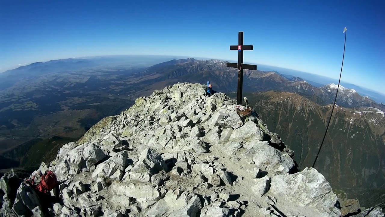


The hiking ascent to Kriváň (2494 m above sea level) is extremely attractive and popular. Kriváň (2494 m above sea level) is the 10th highest hill in the High Tatras.
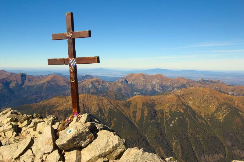
The Cyril and Methodius Cross is located on the top. Its motif has inspired many poets, painters and photographers. Since time immemorial it has been considered a symbol of national pride of Slovaks. Since the 19th century, regular ascents have been organised by enthusiasts. In 1841, for example, Ľudovít Štúr ascended here.
Kriváň is a characteristic imposing hill in the western part of the High Tatras, rising at the end of the long ridge of the Krivánské Rázsocha, which emerges from the main ridge of the High Tatras from Čubriny. Several ridges fan out from the peak, of which only the southern and southwestern ridges are important for hiking. The southern ridge passes through the Daxnerovo sedlo and Malý Kriváň, below the broad ridge widens and ends at Nad Pavlova. The south-west ridge falls with two more pronounced elevations - Vyšší and Nižší Priehybá - to the wooded Grúnik, a memorial place of the partisans of the High Tatras.
On the southern and south-western slopes of Kriváň there are still visible traces of mining in the 15th-18th centuries (excavated tunnels and the last remains of the walls of the miners' dwellings). Kriváň was visited by famous pioneer explorers of the Tatra Mountains, e.g. the English explorer Robert Townson (1793), the French naturalist Belsazar Hacquet (1794), the Polish geologist Stanisław Staszic (1805) or the Swedish botanist Göran Wahlenberg (1813).
The first winter ascent was made in 1884 by Theodor Wundt and guide J. Horvay. To commemorate the ascent of King Frederick Augustus II of Saxony (1840), the Hungarian monarchists erected an obelisk on the peak, which was soon destroyed by Slovak patriots, participants of the so-called national walks. The first of them took place on 16.8.1841 with the participation of Ľudovít Štúr and Michal M. Hodža. The largest pilgrimage was organized by Štefan M. Daxner in the memorandum year 1861. Since 1955, the traditional ascents to Kriváň have been dedicated to the memory of the SNP and its heroes in the Kriváň area. As a symbolic hill of the Slavs and the freedom of the Slovaks, Kriváň became an important motif in the poetry of the Štúrovo generation and has retained its position in poetry and song to this day.
For pedestrians:
There are 2 hiking trails leading to Kriváň, one of them from Štrbské Pleso.
The starting point of the hike to Kriváň is either Štrbské Pleso along the red trail (1 h) to the Jamské Pleso crossroads and from there along the blue trail (3 h to the top). The second option is the hiking trail that leads from Tři Studničky. From the car park at the former Chalet kpt. Raša, Tri studničky you can get to the top along the green trail and from Krivánské žľab along the blue trail in 3.50h. The hike is not technically demanding but it is quite long and strenuous.

The ascent to Kriváň is a more demanding all-day hike for hikers with good physical condition without the possibility of refreshments along the way. Starting from From Štrbské pleso and we're heading in the direction of Jamské pleso - 1,10h (red mark) along a comfortable forest path with minimal elevation gain to the Crossroads at Jamské Pleso. Here we connect to the hiking trail to Top Kriváňa - 3h (blue marker). The trail starts initially in the forest, gradually the space opens up, later it turns into pure stone, in places with stone rubble. From Crossroads under Kriváňwhere both trails converge From Troch Studnički and from Štrbské Pleso we are waiting for the last most difficult section. The ascent is not technically very demanding, but it is long From the Crossroads at Jamsky pleso we overcome about 1000 vertical meters. Above the crossroads we cross the Daxner saddle and continue along the ridge to the top. The section just below the summit consists of stone slabs, which are a bit more technically demanding. On the ridge we get views of Kriváň Green and to Nižné Terianske pleso. With good visibility we can enjoy breathtaking views, where we can see the Western, High Slovak, Polish and Low Tatras.
We can also go to Kriváň from Three wellswhere access is possible only by car, we have a paid parking lot near the Freedom Road, or we can get here from Štrbské Pleso in 2.20 h (red sign) or 2.10 h (green sign), but if we add the length of the climb itself 3.50 h (green sign), this alternative is not exactly optimal. On the Three Wells we can find the remains of the Važecká hut, which was burnt down by Hitler's troops on 27.9.1944, in its place a new hut was built in 1961, but in 1999 it also burnt down and nowadays we can only find an empty platform with a beautiful view of Kriváň itself. There is also a memorial plaque commemorating the national ascents of Kriváň, a memorial plaque commemorating Kpt. Rasa. After an hour-long steep climb, we will reach a turn-off pointing to partisan bunker under Kriváň a replica of which we can see here after a short walk. The paths meet at the Crossroads under Kriváň, from where they continue together.
The hiking trail to Kriváň is closed every year during the winter closure


Year-round