

Wysoki Groń (904.9 m above sea level) is the highest hill of the Laborecka Upland in the Low Beskydy Mountains. It is located in the northern part of the highlands, on the Slovak-Polish border in the protected landscape area of the Eastern Carpathians, in the district of Humenné.
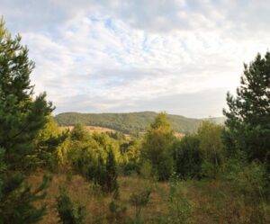
The mountain is a part of the main Carpathian ridge, thus the East Carpathian Highway leads through it. Despite its considerable altitude, the peak itself does not offer more complete views due to the dense vegetation. From suitable locations it is possible to observe mainly the surrounding mountains and nearby mountain ranges as well as distant landmarks, including the Slanské vrchy, Vihorlatské vrchy or the edge of the High and Low Tatras.
Access:
- after
 the sign from the village of Oľšinkov via the crossroads Under the Basket, from there after
  sign (Eastern Carpathian Highway) via Hlboký vrch (893,4 m above sea level)
 - after sign from the village Osadné through the crossroads Balnica (712,0 m above sea level), from there along sign over the Rydošova hill (877,4 m above sea level)
- after mark the ridge in the direction of the Černiny hill (929.4 m above sea level)


Source cover photo: geocaching.com